
GIS Solutions
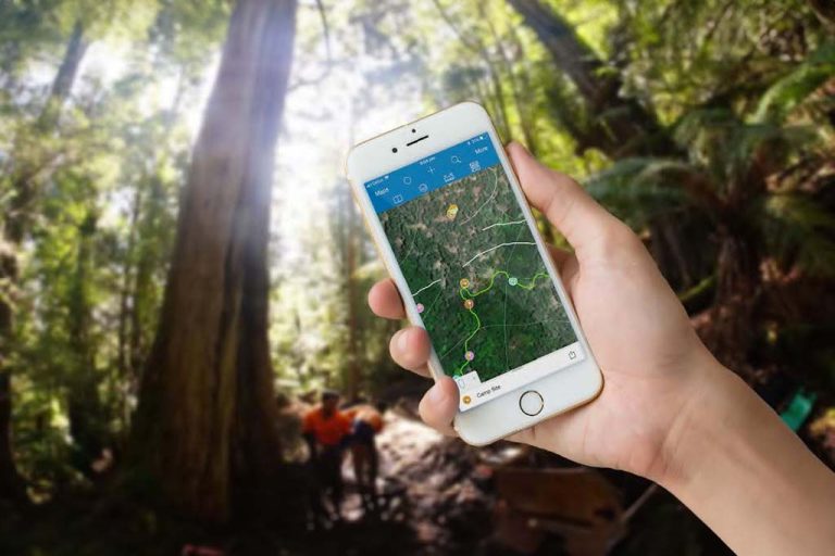
Real-time data collection and monitoring in the field.
Harnessing GIS Solutions for Trail Perfection
At World Trail, we harness the power of cutting-edge GIS technology to meticulously manage and enhance recreational assets, from winding walking paths to adrenaline-pumping mountain biking trails, across parks and public spaces. Our toolkit? High-precision, real-time kinematic (RTK) GNSS receivers that promise unparalleled accuracy, capturing the essence of every trail and turn, even when the terrain gets tough.
Our Office Strategy
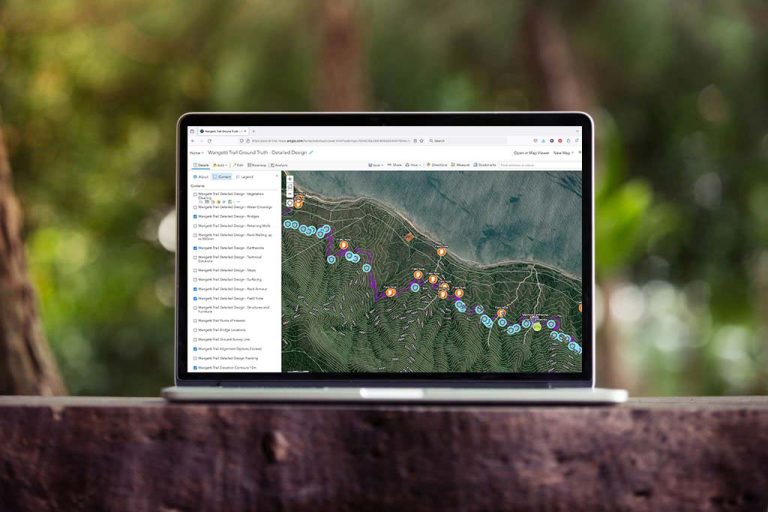
Back in the office, we’re all about seamless collaboration and clarity. By leveraging the robust ESRI ArcGIS platform, we make data sharing a breeze. Our custom-built webmaps act as a single source of truth, ensuring every stakeholder stays on the same page, fully integrated with major government GIS frameworks. Beyond offering instant access to real-time data, we deliver comprehensive reports in versatile formats, including detailed Excel files complete with images and measurements, tailored to the unique demands of each project.
Bespoke Solutions and Accredited Excellence
Our GIS wizards offer constant support to our on-ground trail crew, crafting bespoke software solutions that elevate every project we touch. Plus, with our ISO accreditations in OHS Management, Environmental Management, and Quality Management, you can trust that our operations are always up to the highest standards, ensuring the delivery of excellence from start to finish.
Our GIS services can assist land managers to better manage their recreational parks and assets in the following ways:
- Budget planning, as it relates to programmed maintenance or asset renewal;
- Risk management through a better understanding of the real condition of assets and their associated hazards;
- Updating maps and databases with more accurate spatial data, using the latest technology to ensure the best possible accuracy.
Our GIS services include:
- Mapping of recreational trails and associated assets;
- Condition assessments of trails and associated assets;
- Auditing of walking trails against AS 2156.1- 2001 Walking Tracks – Classification and Signage or Australian Walking Track Grading System;
- Auditing of mountain biking trails against industry guidelines published by the International Mountain Bicycling Association (IMBA) and/or Auscycling (Formally MTBA)
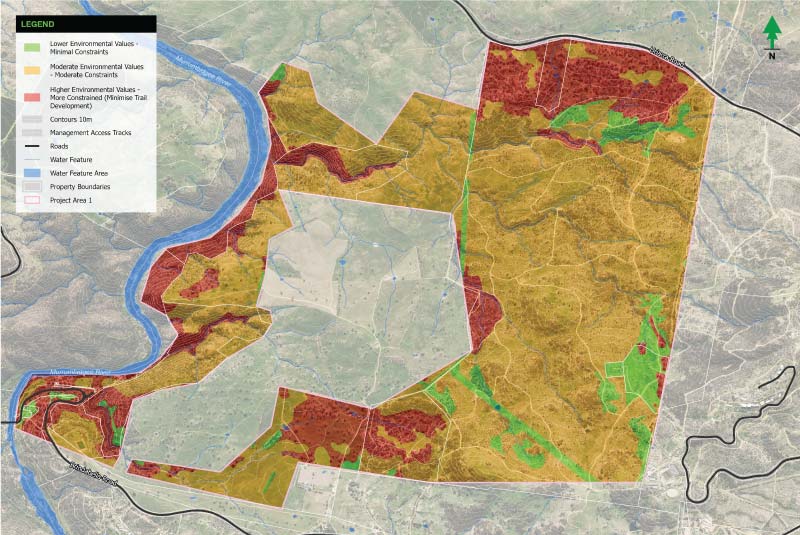
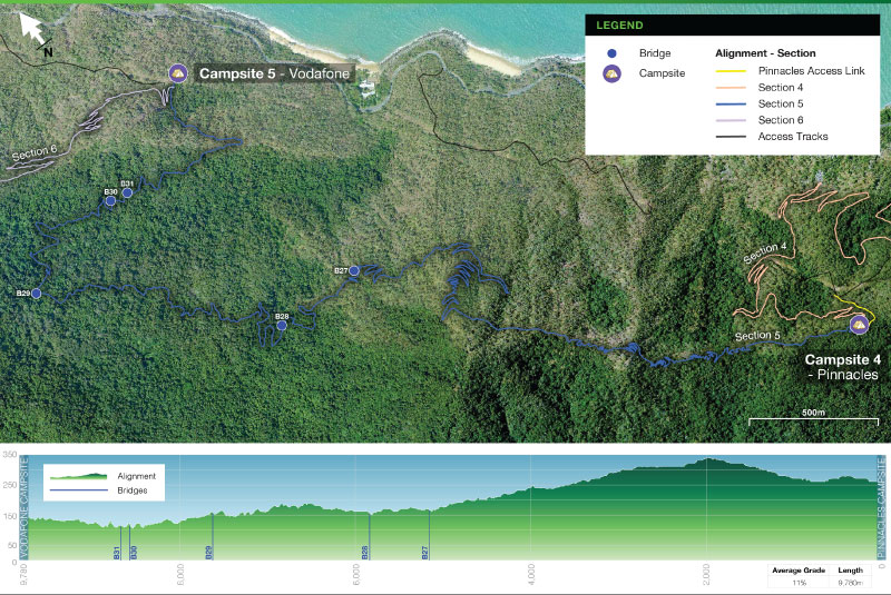
Precise mapping and powerful analysis
Our GIS Solutions refine the art of mapping, turning comprehensive data into detailed, actionable maps for each stage of your project. Harnessing extensive datasets and advanced lidar technology, we provide precise, tailored mapping outputs. Our attention to detail ensures every aspect of your trail is accurately represented.
Trust us to craft the maps that lay the foundation for your trails, where every line and contour is a step toward realisation.
The Power of Advanced Analytics
Beyond facilitating precise trail creation, our GIS Solutions also offer the power of advanced analytics.
With this capability, we’re able to make data-driven decisions about trail placement and design, evaluate potential environmental impact, and even forecast usage trends. Our analytical approach provides invaluable insights, helping us optimise trail design to deliver an unmatched riding experience while preserving the natural integrity of the landscape.
The cornerstone of our success
People are at the heart of what we do.
While we rely heavily on advanced technology, our dedication to collaboration truly fuels our success. We don’t just work for our clients; we work with them, ensuring a cooperative environment where ideas are shared and every voice is heard.
Our team of experts is always accessible, ready to answer your questions, provide updates, and deliver support whenever needed. Together, we create more than just trails; we create world-class destinations that elevate the user experience while celebrating the unique character of the natural environment.